Everything you need to know about Kata Tjuta (The Olgas) in Australia's Red Centre
For a long time known exclusively as ‘The Olgas’ or ‘Mount Olga’ after its highest peak, the famous domes of Kata Tjuta must be seen to be believed.

Credit: Tourism Australia
Considered a must-do for anyone travelling to the Northern Territory, read on to find out everything you need to know about Kata Tjuta before you arrive!
KATA TJUTA BY THE NUMBERS
Meaning ‘many heads’ in the language of the Anangu Aboriginal people (pronounced ‘arn-ung-oo’),who have lived in the region for approximately 30,000 years, the 36 unique domes of Kata Tjuta are estimated to be over 500 million years old!

Credit: Tourism Australia
Changing colour according to the time of the day - from bright orange to deep red, to purple and reddish-brown - the amazing geological structure has featured in countless international tourism ads, and still draws people from all over the world to this part of the remote Australian desert.
Rising to 549 metres above the desert floor at their peak (approximately the same height as the rebuilt World Trade Centre in New York City) this makes them approximately 200 metres higher than Uluru (Ayers Rock), which lies about 40 kilometres to the east.
Also covering an area of 22 kilometres in circumference, (Uluru is just less than 10 kilometres around) the experience of visiting Kata Tjuta is on an altogether grander scale than its much more famous neighbour.

Credit: Tourism NT
UNESCO WORLD HERITAGE SITE
Located inside the Uluru-Kata Tjuta National Park, the physical structure of Kata Tjuta itself was declared a World Heritage Site by UNESCO in 1987.
Recognised for its spectacular geological formations, rare plant and animal species, as well as its outstanding natural beauty, by 1994 UNESCO had officially recognised the special relationship between the natural environment and the belief system of the Anangu, one of the oldest continuing cultures on the planet.

Credit: @themastertraveller
First declared a National Park in 1958, when it was excised from Aboriginal reserve by the government of the time, it wasn’t until 1985 that the Anangu were acknowledged as the traditional owners and given back the title to their highly spiritual homeland. This was the culmination of decades of lobbying by the traditional owners, who continue to live in the area.
Today the park is jointly managed by the Anangu and the Australian National Parks and Wildlife Service, and in 2007 was one of 15 World Heritage listed places included on the National Heritage List of Australia.
ANANGU CULTURE

Credit: The Kulitja Family & The Teamay Family
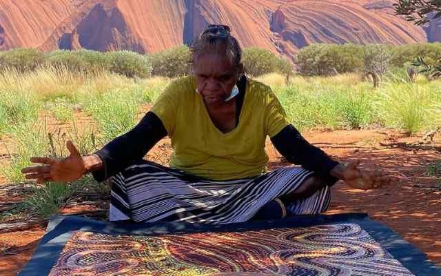
At the heart of Anangu culture is Tjukurpa (pronounced ‘chook-orr-pa’), which is a philosophy that links the Anangu people to their environment and their ancestors.
Stories of Tjukurpa provide the answers to many questions, including the creation of spiritually significant structures like Kata Tjuta.

Credit: @marukuarts
Although Tjukurpa is not necessarily written down, the Anangu continue to use it like a map, telling them where important places are, how to travel from one place to another and where to find water and food.
EUROPEAN DISCOVERY & HISTORY
The first non-Indigenous explorer to come across the incredible domes of Kata Tjuta was the Australian adventurer Ernest Giles.

Ernest Giles. Australian Explorer.
Giles was born in Bristol, England in 1835 but emigrated to Australia with his family in 1850 after they had fallen on hard times. By the age of 17 he had left his family’s original residence in Adelaide and taken off to the Victorian goldfields, and it wasn’t long before that adventurous spirit took him to the outback where he learned how to be a successful bushman.

Giles Expeditions are catlogued in a series of books. The most well known is 'Australia Twice Traversed.'
Setting off from Chambers Pillar in the NT in 1872 - in the first of several attempts to cross the vast Australian continent - it was he who ‘discovered’ the remarkable set of structures, naming its highest peak, ‘Mount Olga,’ as a dedication to Queen Olga of the German Kingdom of Wurttemberg.
Hang on, what?
You heard right.
Because Ernest Giles had been an admirer of the work of the German physician and botanist Ferdinand Mueller, who was one of many Europeans who began travelling to Australia in the late 19th century, (he established the National Herbarium of Victoria and was director of the Royal Botanic Gardens in Melbourne), and Muelller had been awarded the title of Baron for his work by Queen Olga (born the third daughter of the Russian Emperor Nicholas I in St. Petersburg and married to Crown Prince Karl of Wurttemberg who became King in 1864) it was at Mueller’s behest that Giles named the peak ‘Mount Olga.’

Queen Olga turned down several offers before she married the Crown Prince Karl of Wurttemberg in 1846.
It was for this reason that the name ‘Olgas’ became commonplace once early tourism to the area began in the 1950s.
Fortunately, the Indigenous name was formally adopted in conjunction with the name Mount Olga in 1993 and has been in much wider use ever since. Inside the park, the name Kata Tjuta is used exclusively.
WALKING AROUND KATA TJUTA
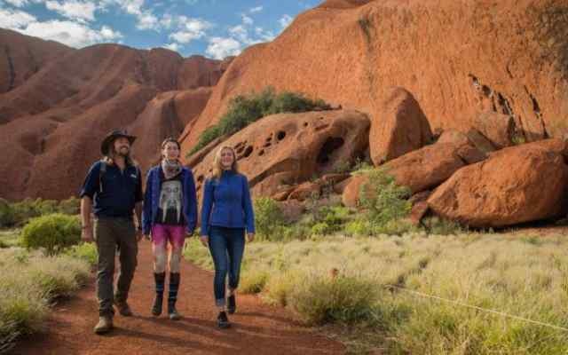
While you are free to explore the ancient landscape of Kata Tjuta at your own leisure, there are two walks we recommend taking that showcase the very best of this incredible piece of history.

Credit: Tourism Australia
WALPA GORGE WALK
2.6km return (Moderate Difficulty)
Walking into Walpa Gorge is like entering an ancient temple crafted by mother nature.
This area is a desert refuge for plants and animals and the entrance to the gorge is often decorated with clusters of pink daisies that bloom in late winter. Inside, a rocky track gently rises to a seasonal stream, passing rare plant species and ending at a grove full of native spearwood.

Map Credit: Parks Australia
VALLEY OF THE WINDS WALK
Karu Lookout - 2.2km return (Moderate Difficulty)
Karingana Lookout - 2.5km return (Medium Difficulty)
The Valley of the Winds Walk is challenging with some steep and rocky sections to navigate, but the views are breathtaking and well worth the effort.

Credit: @_adventuretours
Both paths to separate lookouts immerse you in Kata Tjuta’s spectacular domes. Featuring unparalleled views of what many describe as a Mars-like landscape, the walk is classified as a Grade 4, meaning there are some difficult sections.
The full circuit including both lookouts takes approximately 3-4 hours to complete and drinking water is available at the halfway point. Sturdy footwear and appropriate sun protection is highly recommended.
To get you in the mood, you can listen to the Valley of the Winds audio tour here.
GETTING TO KATA TJUTA
While the earliest non-Indigenous explorers travelled these lands almost exclusively on foot - carrying everything they needed to survive - today Uluru-Kata Tjuta National Park is easy to get to!
Drive
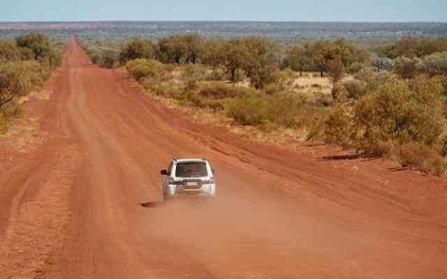
Most visitors come to Uluru-Kata Tjuta National Park as part of a road trip around outback Australia.

Credit: Tourism NT
The Red Centre Way is a multi-day drive of this extraordinary region, taking in Uluru-Kata Tjuta National Park, Watarrka (Kings Canyon), Tjoritja (West MacDonnell Ranges), Alice Springs and Glen Helen.
Uluru is approximately 450 km from Alice Springs by road and signs will guide you toward Kata Tjuta. If you are driving directly this should take about 5.5 hours

Kings Canyon Rim Walk is another must-do on any Red Centre Adventure.
Fly
Yulara has its own airport, called Ayers Rock/Connellan Airport (airport code AYQ).
You can fly directly from a number of Australian cities, including Sydney, Melbourne, Brisbane, Darwin, Adelaide and Alice Springs. Approximate flight times are shown below:
Alice Springs–Yulara: 45 minutes
Adelaide–Yulara: 2 hours
Darwin–Yulara: 2 hours 15 minutes
Sydney–Yulara: 3 hours
Melbourne–Yulara: 2 hours 30 minutes
Brisbane–Yulara: 3 hours 15 minutes
If you’re travelling from overseas or another Australian city, your flight will probably connect via one of the cities above.


