Hiking the Red Centre's Larapinta Trail: top tips
Hiking the Larapinta Trail in Australia’s Red Centre is a true frontier experience.
At 223 kilometres long over Outback bush terrain, the Larapinta Trail from Alice Springs to Ormiston Gorge is both challenging and exhilarating.
This transformative journey allows you to immerse yourself in the rugged beauty of the Australian Outback like few other hiking trails. Spanning the West MacDonnell Ranges in Central Australia, it offers a challenge and reward like no other. You’ll navigate ancient gorges, the hidden oasis of Ellery Creek Big Hole and marvel at the panoramic views from the top of Mount Sonder.
But before you set foot on this awe-inspiring Red Centre trail, it's essential to have all your questions answered so you can tackle your Larapinta Trail adventure with confidence. An epic backpacking trek in the Australian bush is not to be taken lightly.

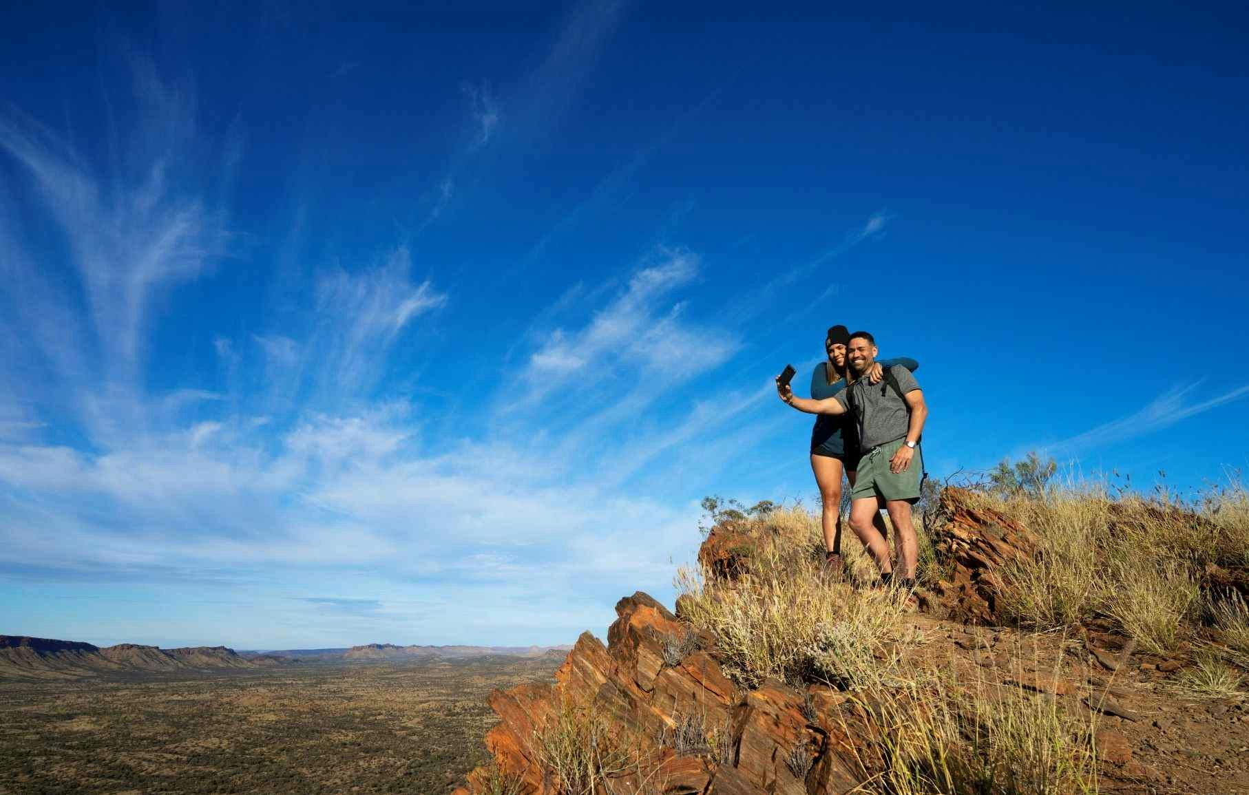
Hiking the Larapinta Trail. Photo Credit: NT Tourism / Paddy Pallin
From Mars-like landscapes and magical swimming holes to epic views of the Red Centre, this iconic hike will not only have you scrambling through deep gorges and across arid mountain ranges, it will also connect you to Country.
How hard is it to hike the Larapinta Trail?
It’s far from easy - officially rated ‘difficult’ by most hiking guides - so for those attempting to get the whole thing done, it’s worth spending the time to prepare. As majestic as it is and amazing as it looks in the photos, this walk will test your willingness to suffer, then have you questioning why you even started, before rewarding you with a host of experiences you will never forget!
What is the best time to hike the Larapinta Trail?
The best time to hike the Larapinta Trail largely depends on your preferences and the weather conditions you're comfortable with.
Central Australia experiences scorching temperatures during the summer months (December to February), often exceeding 40 degrees Celsius. If, like most people, you prefer milder temperatures, consider hiking the Red Centre during the cooler months. The peak season for hiking the Larapinta Trail is from May to September when the weather is more favourable. If you prefer less crowded trails, consider hiking during the shoulder seasons of autumn or spring.
How do I find water on the Larapinta Trail?
According to Larapinta Trail Walk tours, “water tanks can be found along all 12 of the trailhead's along the trail and also along some intermediate points. Park Rangers regularly fill these tanks with water throughout the year. There are two official food storage points along the trail – Ellery Creek and Ormiston Gorge.”
Here are 10 things to know before you set off:
1. You are in Arrente Country
From Mars-like landscapes and magical swimming holes to epic views of the Red Centre, this iconic hike will not only have you scrambling through deep gorges and across arid mountain ranges, it will also connect you to Country.
It’s important to acknowledge that for the duration of any walk you take along the Larapinta, your feet will be in lands that have been home to the Arunda indigenous people for more than 40,000 years.

Waterholes and soaring cliffs on the Larapinta Trail. Image Credit: NT Tourism / Paddy Pallin
Inclusive of 16 traditional estates, throughout the trail you’ll skirt sacred sites and dreaming tracks - some of which are not accessible to the public. These carry deep cultural and spiritual significance, so always respect the law of the land when you’re in these areas. Pay entry to campsites that ask for it and be sure to only swim in those gorges that don’t explicitly ask you not to.
2. It’s hot out here so be sure to carry enough water!
It’s recommended that you take on this trail between April and October, because outside of these times, temperatures have been known to soar. There are water tanks placed at each trailhead (every 15-30km) but be sure that you are not reliant on natural water sources as most of them can dry up!

Wild horses on the Larapinta Trail. Image Credit: Greg Sullavan
3. Start your hike from Alice Springs
Apart from the fact that the trail has been designed this way, walking from Alice Springs means that you’ll always have the sun on your back, and not in your face! It also means that the hardest days of the hike will come at the beginning of the trip and not at the end, when you’re more likely to succumb to the heat.
4. Flash flooding is real
This natural phenomenon can occur along the trail during the warmer months, meaning the river bed can transform from bone dry to a raging torrent in a matter of hours. Be prepared for this fact whenever you decide to camp on apparently dry creek beds.
Read Also: Why Glen Helen is the ultimate base for your Australian outback adventure
5. It’s possible to get mobile reception, but don’t rely on it
On some of the highest points of the West Macdonnell Ranges, it is possible to get enough reception to use your mobile phone. However, if you’re setting off solo, or even hiking with a buddy, it’s recommended you take an emergency beacon. You might only have the chance to regret it once.

Hikers are rewarded with many photo opportunities on the Larapinta Trail. Photo Credit: NT Tourism / Shaana McNaught
6. What does hiking the Larapinta Trail cost?
When we first wrote this blog, access was free. Now, however, you have to pay a small fee for each night you stay on the trail. This pays for the infrastructure, including the vital water tanks. Essentially, it’s $25 a night per person for the overnight trail fee. Camping is extra, with $35 a night being the rate for Parks and Wildlife managed campgrounds.
As mentioned, the Tjoritja/West MacDonnell National Park is full of culturally significant artefacts that need to be respected. Wherever signposted, please adhere to rules about paying to enter campsites or swimming in protected gorges. You can find out more about this - and print maps of the entire region - from the NT Government’s Larapinta Trail website.

Image Credit: Greg Sullavan
7. The best places to camp are up high
It might be tempting to crash in the valley, but you won’t regret the extra sweat when you wake up to unforgettable sunrises that can set an entire mountain range aglow. Brinkley Buff and Hilltop Lookout are only two examples that are absolute must-sees. Camping at the peak of Mount Sonder is not allowed, so be sure to wake up early and make it to the top in time.
Read Also: 10 iconic Australian hikes you can reach from our parks
8. Be honest with your hiking buddies
We all move at different speeds. There could be nothing worse than exhausting yourself on day one of a five day trek because your mate is a veteran of three Everest-summits while you’re on your first multi-day trip. Talk to each other BEFORE frustration and fatigue sets in, (which it will) and strongly consider walkie talkies if anything should go wrong. In any case, part of the attraction of the wide open spaces is the wide open spaces.

Sunsets are beautiful – but nights can be cold. Be prepared! Image Credit: Greg Sullavan
9. Take only pictures, leave only footprints
There are no bins on the Larapinta Trail, so take only what you need and leave nothing behind. This includes food, which if you’re taking on the full distance can be organised in drops with the help of the Larapinta Trail Trek Support team. An amazing service that comes highly recommended.
10. Pack light but don’t forget anything!
This is obvious, but just like walkie talkies and emergency beacons, it’s worth having everything you need when you need it. Mosquito repellent is a case in point because depending on the time of year, there’s hardly any respite from the Territory's wide range of flying midgies. Sunscreen is also vitally important, as is a sturdy water bottle, which may literally save your life!

Pack light but pack right when backpacking the Larapinta Trail. Image Credit: NT Tourism / Paddy Pallin
For a thorough breakdown of each of the 12 sections of the Larapinta Trail we highly recommend this article by We Are Explorers. It takes you through the highlights, unmissable geographical features and gives a summary of the type of walking required from Alice Springs to Ormiston Gorge. Also very useful is the comprehensive Larapinta Trail website which has maps, videos and more information about this iconic outback adventure!
Highlights and must-see attractions on the Larapinta Trail
Ellery Creek Big Hole: This stunning waterhole is a hidden oasis in the desert. Take a refreshing dip in its cool waters and marvel at the surrounding red cliffs.
Ormiston Gorge: Towering walls and permanent waterhole. Enjoy a swim or relax by the water's edge.
Mount Sonder: Standing at 1,380 metres, Mount Sonder is the highest point along the Larapinta Trail. Summiting this majestic peak rewards hikers with fantastic views of the surrounding landscapes.
Serpentine Gorge: Follow the trail through the narrow gorge, surrounded by soaring cliffs, and be rewarded with a small waterhole at the end.
Simpsons Gap: This iconic site is easily accessible from Alice Springs and offers a taste of the Larapinta Trail's beauty. Keep an eye out for black-footed rock wallabies.
Safety when hiking the Larapinta Trail
These are just a few of the many highlights along the Larapinta Trail.
And at this stage, it’s worth pointing out the obvious need to look after your safety.
- Navigation skills are important when hiking the Larapinta Trail, as the trail is not always perfectly marked and can be challenging to follow. Here are some tips to help you navigate safely:
- Maps and Guidebooks: Carry a detailed map and guidebook of the Larapinta Trail. Familiarise yourself with the trail's route and key landmarks before setting out.
- GPS and Mobile Apps: Use GPS devices or mobile apps specifically designed for hiking to track your progress and ensure you're on the right path. However, always have a backup plan in case of device failure. Phone reception is poor or non-existent.
- Trail Markers: Look out for the distinctive Larapinta Trail markers along the route. These markers are usually metal posts with a distinctive yellow symbol, indicating the direction of the trail. write in all logbooks located at the Trailheads so that in the case of an emergency, Rangers can track your movements.
- Compass and Navigation Skills: Learn basic compass navigation skills and practice using a compass before your hike. This will come in handy if you encounter challenging sections or need to navigate off-trail.
- Buddy System: Hiking with a partner or in a group is recommended for safety reasons. If you choose to hike alone, inform someone reliable about your itinerary and expected return date.
- Always prioritise safety and be prepared for unexpected situations. Carry a first aid kit, know how to use it and be aware of emergency procedures in case of accidents or injuries.
Get your hiking boots on
Are you ready to explore the untamed beauty of the Australian Outback? If so, lace up your hiking boots, pack your backpack, and let the Larapinta Trail take you on an unforgettable journey of self-discovery and connection with nature.


